Log in
All resources
Create a design
430 Free Images of Maps Antique
grabados
cartografía, mapas | cartography, maps
illustration
engraving
cartography
cartografía
fondo antiguo
17th century
italy
italia
illustration
maps
illustration
maps
illustration
maps
illustration
maps
illustration
maps
illustration
maps
illustration
maps
illustration
maps
illustration
maps
illustration
maps
illustration
maps
illustration
maps
illustration
maps
illustration
maps
illustration
maps
illustration
maps
illustration
maps
illustration
maps
illustration
maps
illustration
maps
illustration
maps
illustration
maps
illustration
maps
illustration
maps
illustration
maps
illustration
maps
illustration
maps
illustration
maps
illustration
maps
illustration
maps
illustration
maps
illustration
maps
cave of the drum-koba
moritz vebel
maps of paris from paris musées
baroque
illustration
maps
illustration
maps
history
maps
illustration
maps
recueil d'antiquités égyptiennes, étrusques, greques et romaines (1756)
historical images of paris
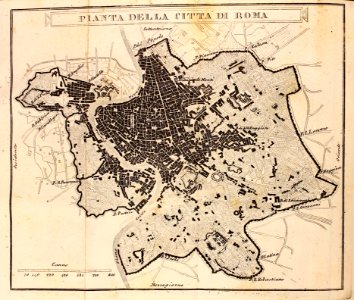
old maps of rome
antonio lafreri
maps of aachen by braun & hogenberg
bibliothèque nationale de france
maps of ancient italy by philipp clüver
old maps of marche
atlas des anciens plans de paris by imprimerie nationale, 1880 from bhvp
baroque
novopavlovka
moritz vebel
illustration
maps
illustration
maps
illustration
maps
illustration
maps
illustration
maps
illustration
maps
bibliothèque nationale de france
guillaume sanson
bibliothèque nationale de france
guillaume sanson
bibliothèque nationale de france
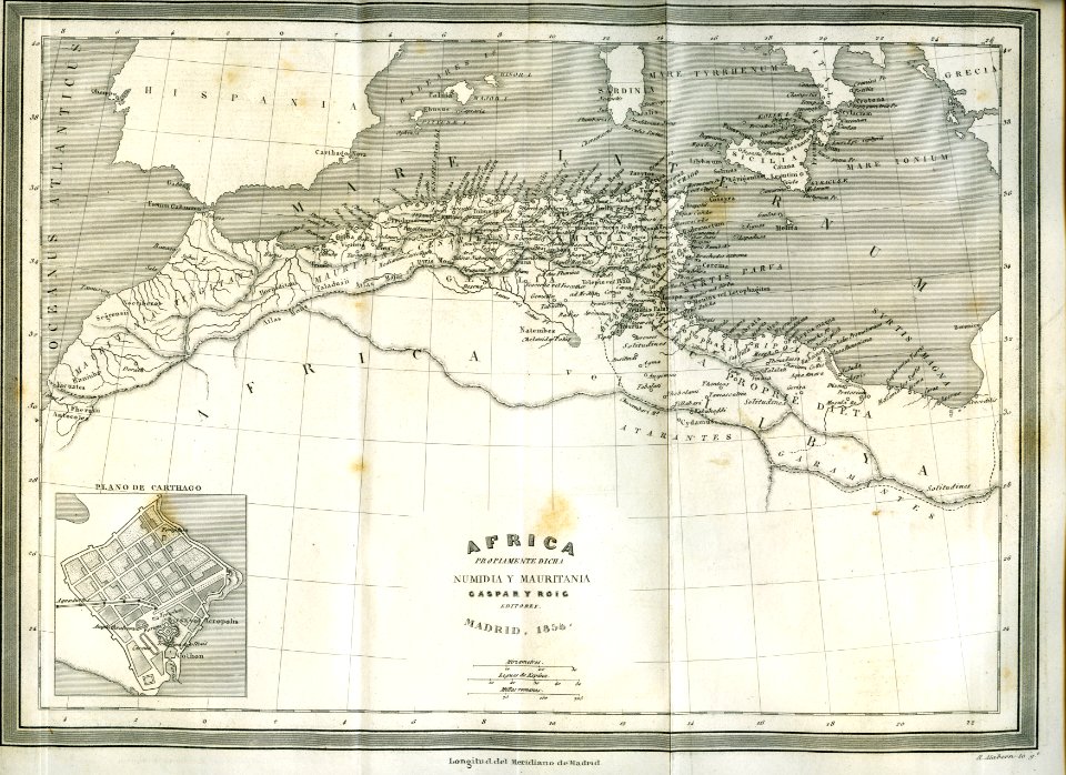
1667 sanson map of africa
1667 sanson map of africa
1702 maps of africa
17th-century maps of the holy roman empire
maps by pieter van der keere
illustration
maps
illustration
maps
illustration
maps
maps by jean-baptiste bourguignon d'anville
old maps of roman hispania
maps of brussels by braun & hogenberg
illustration
maps
illustration
maps
illustration
maps
illustration
maps
constantine and helena church (mangup)
moritz vebel
the custom house, dublin (1707)
1766 fleurons
the custom house, dublin (1707)
1766 fleurons
illustration
book
map of ancient asia minor by philippe de la rué
bibliothèque nationale de france
atlas des anciens plans de paris by imprimerie nationale, 1880 from bhvp
baroque
maps by nicolas sanson
guillaume sanson
maps by nicolas sanson
guillaume sanson
map of the bosphorus strait by guillaume sanson (1665)
bibliothèque nationale de france
map of the bosphorus strait by guillaume sanson (1665)
bibliothèque nationale de france
historical collections of the state of new jersey (1852)
bibliothèque nationale de france
guillaume sanson
bibliothèque nationale de france
guillaume sanson
illustration
maps
maps of ancient israel by philippe de la rué
map of modern syria by philippe de la rué
le plan de la ville, cité, université fauxbourg de paris by melchior tavernier
maps of paris from bibliothèque nationale de france
sphinxes in art
1726 fleurons
historical collections of the state of new jersey (1852)
1852 maps of the united states
pierre moullart-sanson
guillaume sanson
map of ancient asia minor by philippe de la rué
bibliothèque nationale de france
map of ancient asia minor by philippe de la rué
bibliothèque nationale de france
bibliothèque nationale de france
1667 sanson map of africa
maps of ancient israel by philippe de la rué
old maps of the united monarchy
travel
book
travel
book
illustration
book
illustration
book
map of ancient asia minor by philippe de la rué
bibliothèque nationale de france
high renaissance
pirro ligorio
illustration
book
illustration
book
illustration
book
cartouches by guillaume delisle
philippe buache
maps of the iberian peninsula by guillaume delisle
1700s maps of the iberian peninsula
carte de barbarie, nigritie, guinée par guillaume delisle (1707)
university of washington
carte de l'isle de ceylan by guillaume delisle (1722)
philippe buache
301 - 400 of 430
Next page
/ 5